Skip to content
  • Home Page
    • About
    • GIS Services
    • Posts
      • 2020 Photographs
      • 2019 Photographs
      • 2018 Photographs
  • Story Maps Home Page
    • First State National Historical Park
    • Wolf’s Hollow Story Map
    • Catoctin Mountain
    • Mahoning Valley
    • White Clay Creek, Pennsylvania
    • Valley Forge
    • Skippack Creek Evansburg St Park
    • Auburn Valley State Park
    • Kennett Township Open Space
    • Classic Story Maps
      • Appalachian Trail, Pennsylvania
      • Appalachian Trail Story Maryland
    • Lewes Historic District
    • Great Outdoors of South Texas
  • Preserve Collection
Hudson Geography
Hudson Geography
  • Home Page
    • About
    • GIS Services
    • Posts
      • 2020 Photographs
      • 2019 Photographs
      • 2018 Photographs
  • Story Maps Home Page
    • First State National Historical Park
    • Wolf’s Hollow Story Map
    • Catoctin Mountain
    • Mahoning Valley
    • White Clay Creek, Pennsylvania
    • Valley Forge
    • Skippack Creek Evansburg St Park
    • Auburn Valley State Park
    • Kennett Township Open Space
    • Classic Story Maps
      • Appalachian Trail, Pennsylvania
      • Appalachian Trail Story Maryland
    • Lewes Historic District
    • Great Outdoors of South Texas
  • Preserve Collection
Home » Posts » 2015 Photographs » Pocopson Park in January
2015 Photographs

Pocopson Park in January

by hudsongeography|Published January 30, 2015

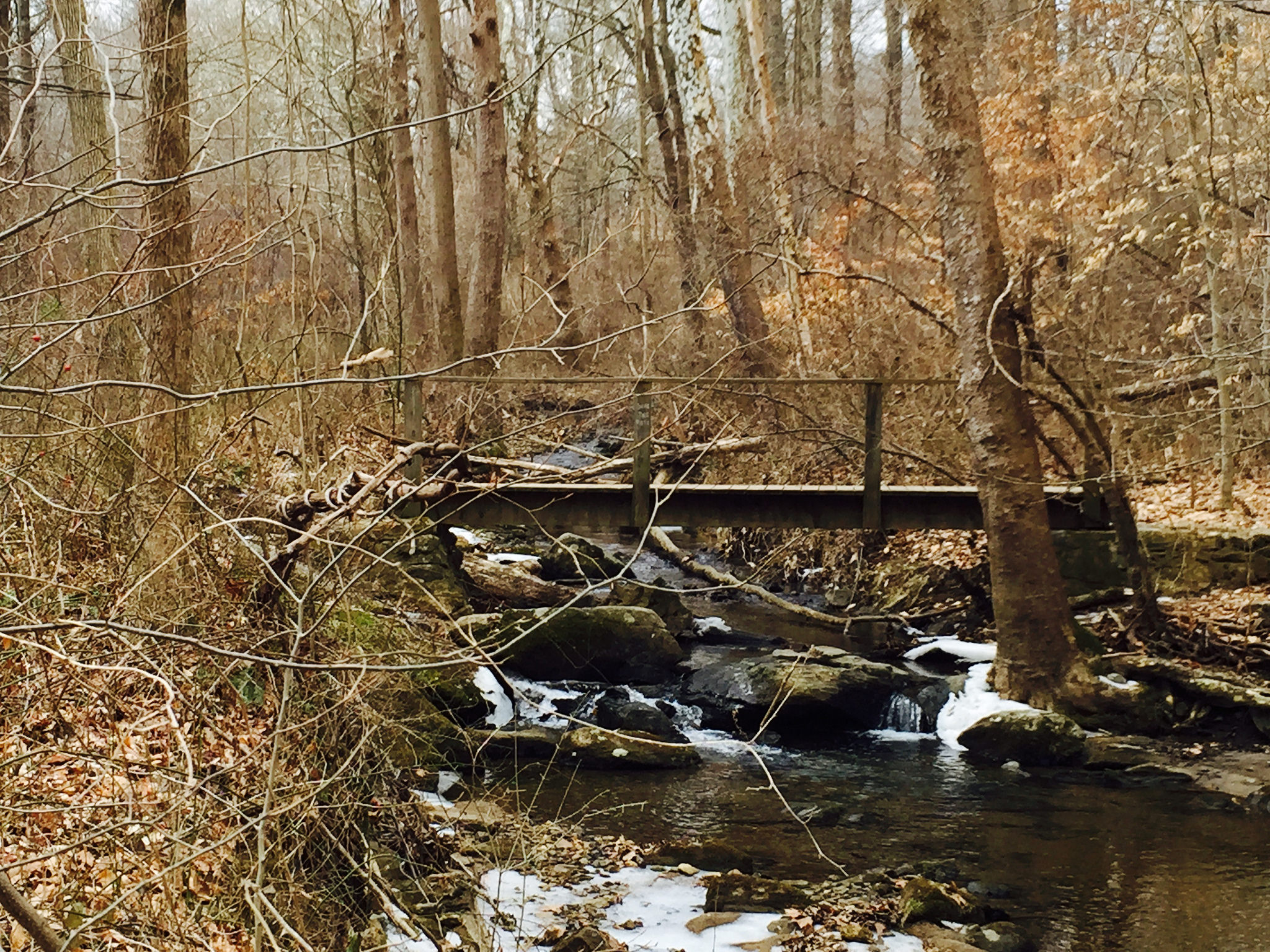
While enjoying a cold brisk walk I couldn’t resist capturing Pocopson Walking Trail with the white scenery!
Pocopson Walking Trail with Snow

Share this:

  • Share
  • Share on Facebook (Opens in new window) Facebook

You may also like

Published September 26, 2015

September 2015

Brandywine Trail from Brinton Bridge Road >> Over RR >> Brandywine Creek and Anson B Nixon Park was an early Autumn walk

Share this:

  • Share
  • Share on Facebook (Opens in new window) Facebook
Published March 17, 2015

Rococas State Park

This photo was taken in early March 2015 and has one of the new camera options on iPhone. This is on the […]

Share this:

  • Share
  • Share on Facebook (Opens in new window) Facebook
Published November 6, 2015

Autumn Red Clay Creek

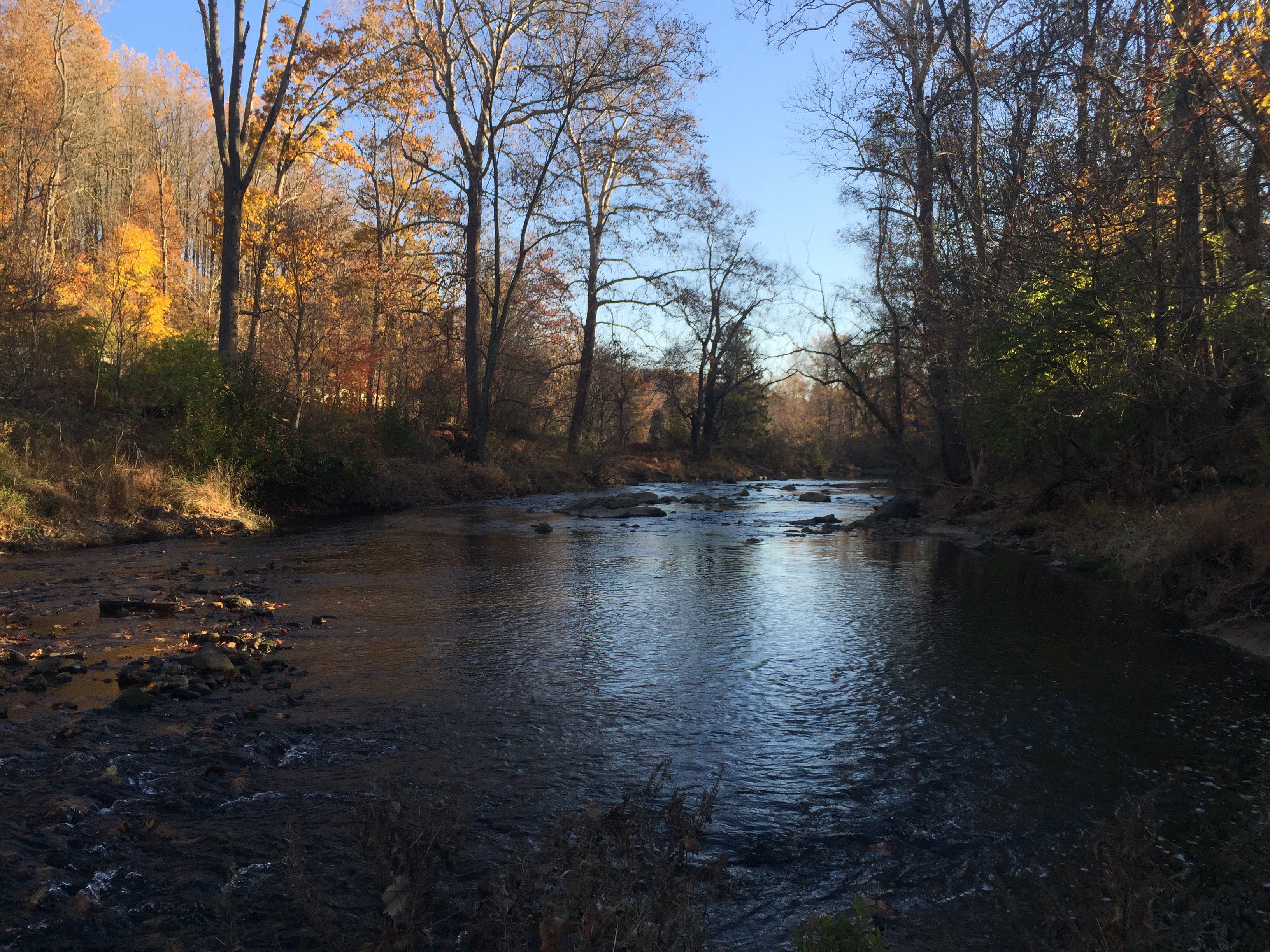
Photographs along the hike are now within an ArcGIS Online application: Autumn Red Clay Creek 2015

Share this:

  • Share
  • Share on Facebook (Opens in new window) Facebook
Published July 18, 2019

Volunteer Geography Story Map (beta)

Click on the photograph to browse Story Map!

Share this:

  • Share
  • Share on Facebook (Opens in new window) Facebook

Post navigation

  • Previous post First Post
  • Back to post list
  • Next post Ridley State Park
Privacy & Cookies: This site uses cookies. By continuing to use this website, you agree to their use.

To find out more, including how to control cookies, see here: Cookie Policy
ArcGIS

Hudson Geography Organization Home Page

Hudson Geography Hub Site

Recent Posts
  • Wolf’s Hollow
  • Kellys Run
  • Welsh Mountain Preserve

© 2026 Hudson Geography – All rights reserved

– Powered by


Loading Comments...